Mostrar el registro sencillo del ítem
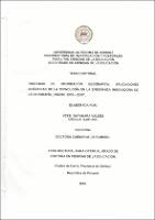
"Sistema de información geográfica: aplicaciones didácticas de la tecnología en la enseñanza innovadora de la geografía, UNACHI. 2018-2019".
| dc.contributor.author | Valdés, Yessi Dayanara | |
| dc.date.accessioned | 2023-08-08T15:14:40Z | |
| dc.date.available | 2023-08-08T15:14:40Z | |
| dc.date.issued | 2019 | |
| dc.identifier.uri | http://jadimike.unachi.ac.pa/handle/123456789/818 | |
| dc.description.abstract | Los sistemas de información geográfica representan una integración de hardware y software de uso para los científicos e investigadores, estos sistemas son útiles para el estudio de la geografía. El estudio de las actividades humanas en la superficie terrestre y la composición física de la misma. El estudio se llevó a cabo con miras a demostrar que la forma de estudiar geografía ha cambiado, la tecnología ha revolucionado en muchos aspectos de la vida de los seres humanos y el campo de la educación superior es uno de ellos. El objetivo general del estudio se fundamentó en evaluar los sistemas de información geográfica, aplicaciones didácticas de la tecnología para la enseñanza innovadora de la geográfica. Por otro lado, se planteó una hipótesis de trabajo: Los sistemas de información geográfica, aplicaciones didácticas de las tecnologías son eficaces para la enseñanza innovadora de la geografía, la cual se comprobó a través de los resultados obtenidos con la aplicación de los instrumentos que en este caso fueron la encuesta con escalas de Likert y la entrevista. Se pudo concluir que los sistemas de información geográficos como el ArcGis es la aplicación más adaptable al entorno de las aulas de la Escuela de Geografía e Historia en la Universidad Autónoma de Chiriquí. | es_ES |
| dc.description.abstract | The geographic information systems represent an integration of hardware and software used by scientists and researchers. These systems are useful for the study of Geography in the study of the human actions into the earth's surface and its physical composition. The study was dutifully carried out with the view to demonstrating that the way of studying Geography has changed. This is due to that technology has revolutionized in many aspects concerning the life of human beings as well as in the field of higher education. The overall objective of the study was based on the evaluation of the geographic information systems and the educational applications of technology for the innovating teaching practice of Geography. On the other hand, the argument was proposed on a working hypothesis. Through the application of the instruments such as the use of survey and interview survey with the Liken scale, the given results proved that the geographic information systems and the educational applications in technology are effective for innovating teaching practice. It was possible to conclude that the geographic information system such as ArcGis is the most adaptable application to the learning environment in the School of Geography and History at Universidad Autónoma de Chiriqui. | en_US |
| dc.language.iso | es | es_ES |
| dc.publisher | Universidad Autónoma de Chiriquí | es_ES |
| dc.subject | GEOGRAFÍA -- ENSEÑANZA -- 2018-2019 -- (CHIRIQUÍ - PANAMÁ) | es_ES |
| dc.subject | GEOGRAFÍA -- TECNOLOGÍA DIGITAL -- 2018 - 2019 | es_ES |
| dc.subject | SISTEMA DE INFORMACIÓN GEOGRÁFICA (PANAMÁ) | TESIS -DOCTORADO EN CIENCIAS DE LA EDUCACIÓN | es_ES |
| dc.title | "Sistema de información geográfica: aplicaciones didácticas de la tecnología en la enseñanza innovadora de la geografía, UNACHI. 2018-2019". | es_ES |
| dc.type | Thesis | es_ES |

